E-learning : discover our plaform for interactive learning (1'52 min.)
A simple, intuitive interface to connect, choose the learning program, discover modules and interactive learning sequences.
A range of tools to ensure your complete self-learning.
Click the [ ] icon to view the video in full screen mode.
A teaching program tailored to your needs and business
The teaching programs are put together in a way that promotes the assimilation of the methods and product knowledge behind the GEOCONCEPT range.
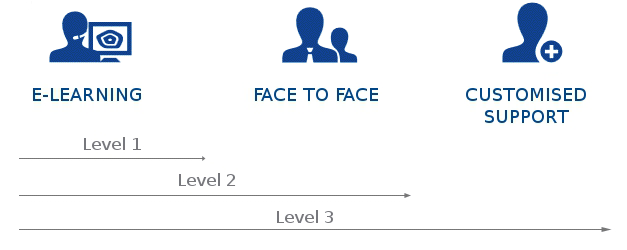
Whether face-to-face, e-learning or a blended learning model, GEOCONCEPT offers you a comprehensive teaching program ensuring the efficient transfer of skills tailored to your way of working and business expectations.
![]()
E-learning
Comprising several product learning programs, the e-learning platform offers a number of teaching programs. Each of these programs is dedicated to a product in the Geoconcept range and enables you to understand the main features of the product in question.
![]()
Face to Face
Our face-to-face training courses are intended for an audience that quickly wants to grasp how a product in the Geoconcept range works. Learning to use our solutions' features in a workshop environment and in coaching mode facilitates the assimilation of knowledge.
![]()
Blended learning
This type of learning combines e-learning and face-to-face learning.
E-learning enables the step-by-step discovery of mapping application features. An extension to this self-learning is a one-day classroom training session enabling more in-depth knowledge of the tool by means of complex supervised exercises and the acquisition of a working method.
![]()
Customised support
We can help you get started with and implement your application for any large-scale project in terms of the number of users or volume of geographical data to be processed, or because of your lack of cartographic experience.
GEOCONCEPT can provide you with a consulting engineer to set up the database, design the model, organize the data to be processed as required, apply the methodology and transfer skills.
A consulting engineer can assist you at any time, on an ad hoc basis, to take your application forward or upgrade it, to take over the reins for a while or for any other reason.
Don't hesitate to get in touch with your business engineer for any request for customized support.
User certification
Certification is a way of validating your technical knowledge and grasp of the tools in the Geoconcept range to give prominence to your skills.
Our publications
To assist you in discovering its solutions, GEOCONCEPT has published two books with publishers Plein Pot: one of them dedicated to Geoportail, developed on the back of GEOCONCEPT technologies, the other intended for learning geomarketing techniques through a number of practical scenarios.