Are you responsible for directing sales teams?
Do you manage the organization of logistic depots, service locations or the assignment of teams on the ground?
Geomarketing tools enable you to combine your company's data with geographical information to establish the optimal partitioning of sectors and improve the distribution of your activities throughout the territory in question.
By taking account of business sectors and geographical constraints, geomarketing tools enable you to define the optimal sectors for exploiting the territories' sales potential to the full.
Geographical optimization also allows you to define the most appropriate prospecting or visit sectors for your mobile teams.
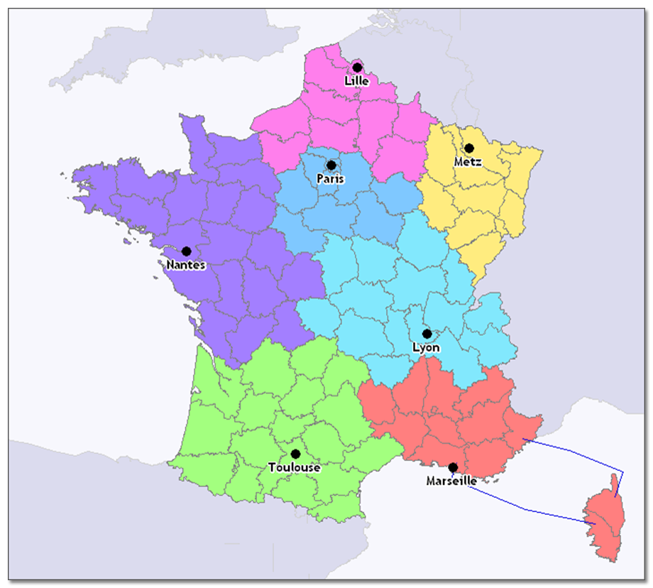
Our geomarketing tools enable you to model your sales sectors.
For example, you can link all the communes in the territory that has been analyzed to your retail outlets based on accessibility or distance criteria and compare these sectors.
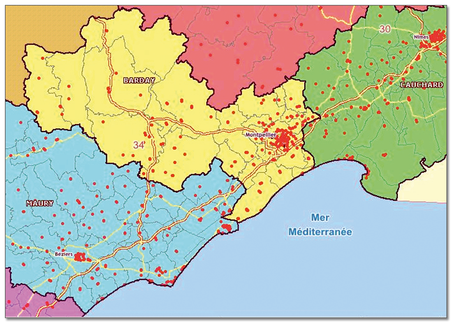
redistricting enables you to evaluate the organization of your distribution or service network. It is an indispensable decision support tool for defining new locations and rebalancing your sectors.