Features
Insertion of points and distances by manual data-entry or by clicking with/or without snapping. For distance, it is possible to enter a measured distance and spread the difference across the various points.
- Distance between two points: calculation of the distance between two points on the map
- Alignment: Data-entry along the segment defined by two reference points
- Orthogonal, parallel or perpendicular survey: creation of a point along the length of a base with orthogonal measurements (x and y axes);
- Intersection of two distances: Entering a point from the coordinates of two reference points and the distance between these points and the point to be positioned
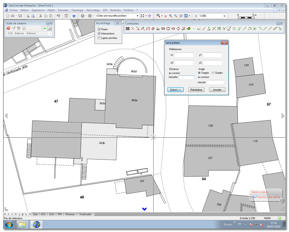
- Polar survey: Creation of a point at a certain (definable) angle and a certain distance from a segment defined by two reference points
- Drawing a circle: Creation of a linear or surface object in the form of a circle with a definable center and radius;
- Orthogonal route: Creation of a point while complying with an orthogonal route
- Intersection of a straight-line with a circle and arc with three points
- Adjustment, cutting and displacement of a line
- Smoothed polyline
- Intersection of 3 distances