Mass geocoding
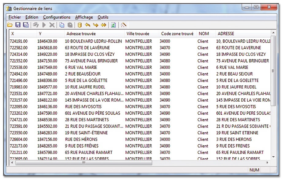
Geoconcept Universal Geocoder enables files containing millions of addresses to be geocoded quickly and efficiently. Also known as batch geocoding, mass geocoding can be performed at town, district, street or house number level.
Customization
The various fields defined in Geoconcept Universal GeoCoder prompt the acceptance of reference addresses. The output addresses are then homogenous and identical to the chosen map reference. The address files are enriched with geographical coordinates and customized addresses.
Unicode
Geoconcept Universal GeoCoder's Unicode compatibility makes it possible to work with all charactere types, thereby facilitating international exchanges.
Strategies
Geoconcept Universal GeoCoder enables you to select your own geocoding strategies. For example, to improve the results achieved, it is possible to include one or a number of so-called strategic elements, such as phonetic name recognition, the inclusion of the first two digits of the postcode and so on.
Self-learning
The associations created by the user in the course of interactive error processing are memorized in editable XML file. Thanks to this spell checking, errors are automatically corrected should they recur.
District and sector
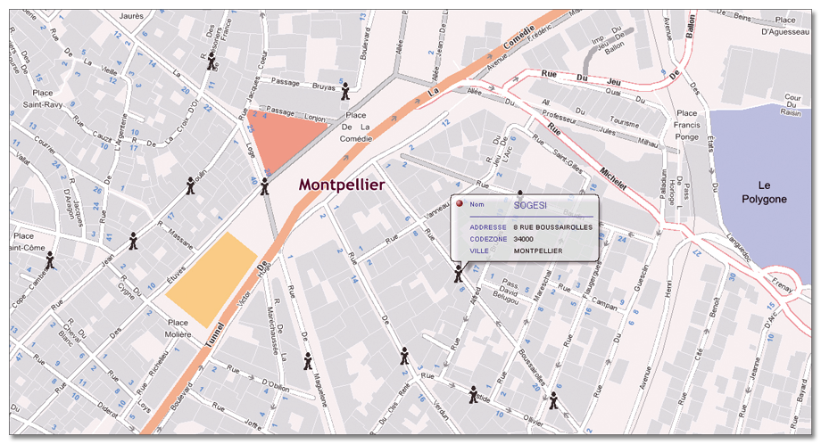
To address the needs of socio-economic analyses based on government statistical units, Geoconcept Universal GeoCoder geocodes at the defined district or sector level (e.g. sales sectoring, IRIS, islands, zip code…) using a reference table enriched with an appropriate breakdown.
Projection
To ensure the best possible fit with each working environment, Geoconcept Universal GeoCoder returns geographical coordinates in any coordinate system chosen by the user: Lambert II extended, Lambert 93, UTM North, and a host of others.
Customization of grammar
As the XML file is editable, the user has complete control of the geocoding grammar. For example it is possible to add types of thoroughfare or abbreviations specific to a country or activity, to ignore specific words recurring in the addresses…
Web services
The multiplatform (Linux, Unix, Windows) geocoding web component enables geocoding web services to be created and shared, thus embedding geocoding at the heart of the web business applications.
Customized reference table
Geoconcept Universal GeoCoder’s Builder version allows you to easily configure and create reference tables for geocoding addresses.