Quickly identify the nearest provider, define an access zone around a location, calculate the best route between two or more points….
Mobility is ubiquitous, use route APIs to make it part of your application.
Try out Geoptimization APIs Try out route API online demonstrator
Route calculation (unitary and batch)
This API calculates the best route between two points and possible intermediate stages. It also sends a comprehensive route map and allows to calculate several routes simultaneously.
Vehicle profiles, truck attributes
This API takes into account specific attributes making it possible to calculate routes adapted to different vehicle profiles (car, heavy goods vehicles, bicycles, transport of dangerous materials, etc.).

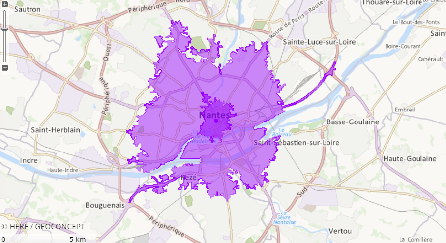
Calculating isochrones/isodistances
Need to identify the area within 15 minutes or 2km by road around a shop, agency, fire hydrant? The isochrone and isodistance calculation API is ideal for improving marketing activity reliability, new opening projects, callout plans...
Route scheduling
This API defines a resource’s optimal route, minimizing travel times and distances. The call destinations are optimized taking account of geographical and operational constraints (timeslot, call duration).
Search around function
Emergency assistance, approved repairers, pick-up/drop-off points, car parks... The search around function API classifies the resources closest to a given point in order of access time or distance.
Matrix calculation
Calculating the distances between thousands of locations takes just a few seconds with this API, the most powerful of its type on the market. The resulting distance table is indispensable for numerous purposes, such as route optimization, carsharing...
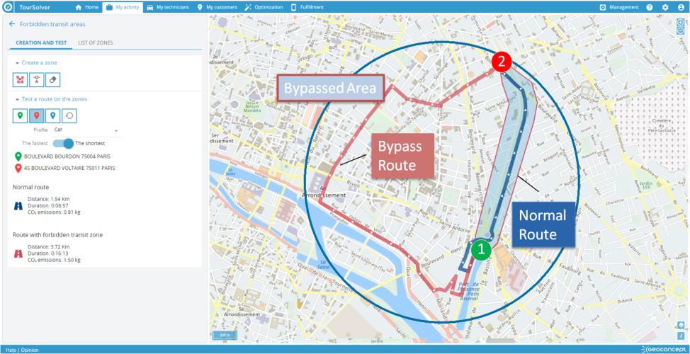
Bypassed areas
Drawing bypassed areas means to be able to design routes that avoid road sections or geographic zones that are temporarily blocked or congested. For example, a street market, road works, restricted traffic areas or a thoroughfare that is blocked for an event (demonstration, sporting event, street carnival etc). This API allows you to manage the specific accessibility of certain areas and to offer alternative routes that meet the reality on the ground. These bypass areas (or prohibited road areas) can be defined by type of vehicle.
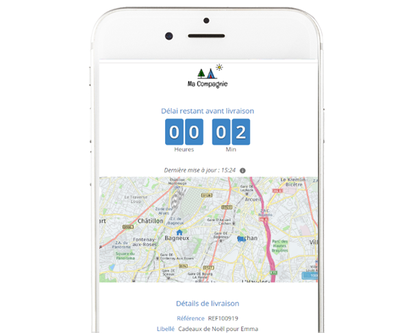
Estimated Time of Arrival (ETA) calculation
Delivery and field services are a crucial element of the customer relationship. Maximising customer satisfaction requires the provision of a quick and reliable service as well as regular and transparent communication on delivery/intervention status.
The dynamic ETA API enables the end customer to track in real time the status of his delivery/intervention in real time.
There is an accident on the field worker's route? The journey time is automatically recalculated to update this estimated arrival time.

Cost of tolls
When calculating a route, this functionality automatically calculates the cost of the toll (s) on the route depending on the vehicle selected.

Carbon footprint calculation
Our APIs allow us to assess the carbon footprint associated with routes calculated according to the type of vehicle.
Search along
Need to add a last minute delivery to your routes? need to make an additionnal prospecting appointment? useful to identify a point of interest (hotel, restaurant…) nearby your way? With this API, finding the shortest and so the most profitable detour takes only a few seconds!
Pickup and delivery
This API offers the best pick&drop and pick&deliver solutions for the transportation of people and goods. The algorithm looks for the ideal collection and removal points on existing paths. cherche les points de ramassage et de dépose idéaux sur des trajets existants. It indicates the best possible detours for each trip.