Real time monitoring of dynamic simulation entities
The HLA 1516-2010 standard makes it possible to integrate a real time force training or crisis management simulation platform (co-located exercises, exercises between remote sites or internationally). Capable of being accessed from the Geoconcept Defense Enterprise GIS, the HLA for Geoconcept module makes it possible to connect to any distributed architecture thanks to the HLA Standard and in particular to serious game VBS2.

A powerful decision support tool
Geoconcept Defense Enterprise is an Operational Information System (OIS) dedicated to defense, based on the powerful Geoconcept GIS (Geographical Information System) and on specific military decision support features, based on the relationship between geographical and operational data.
Geoconcept Defense Enterprise enables civil and military data (EMA/BGHOM/EGI) to be imported and superimposed. It also boasts features for creating and publishing operational data in the form of dots lines and surfaces. These data can then be documented with multi-media information (photos, videos), analyzed, queried, and shared within a network in Client/Server mode or Web mode and exchanged interoperably with other information systems.
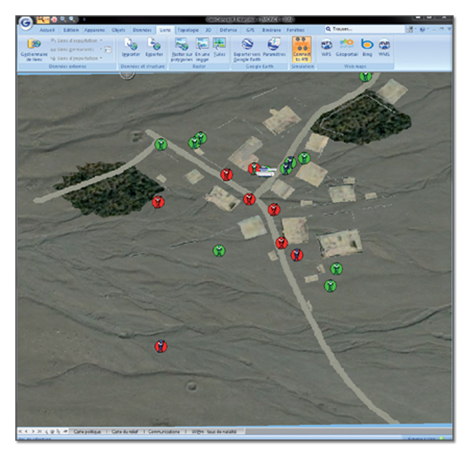
The HLA for Geoconcept module enables simulator entity movements to be retranscribed and monitored within a geographical environment dedicated to defense.
How GIS and simulation complement one another
When connected to the network the HLA for Geoconcept module listens out for federates and retranscribes the movement of the simulated mobile entities to the Geoconcept Enterprise Defense GIS. This enables real time monitoring of the dynamic entities of a simulation from a top-down decision-making perspective. This perspective complements the immersive perspective of the simulators, which submerges the operator in his training environment (for example VBS2).
Geoconcept Defense Enterprise depicts a military or civilian base map, displaying the movement of entities, aggregated or otherwise (tanks, infantry, friendly or enemy positions, drones…) on it in the form of colored icons according to customized professional symbols. This representation provides operators with a rapid appreciation of the operational situation and reduces the risk of mistaken identity during an engagement when participants are in a stressful situation.
In the case of the DGA’s VULCAIN demonstrator unveiled at SIMDEF13, the HLA for Geoconcept module monitors all the simulators within the federation and organizes the training of the command forces: VBS2 from Bohemia Interactive Simulations, Masa Group’s SWORD, ORQUE from Cassidian, Antycip Simulation’s VR-FORCES, SETHI from Thales.