New census data For India
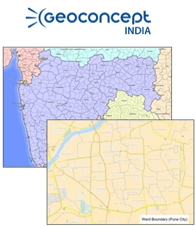
GEOCONCEPT India brings out a complete and detailed grid of the administrative divisions of India as per census 2011 from state to the village/town unit level and additional ward level units for major cities of India. With about 595904 administrative units and over 99 % of the population mapped at village and town level, this dataset is one of the most comprehensive version of the Indian census 2011 administrative divisions available in the market today.
GEOCONCEPT India also offers the Indian census 2011 socio-demographic data as a standard along with the administrative unit mapping which includes 85 statistical demographic indicators and will shortly also include approximately around 125 amenities, households and economic statistical indicators.
As a further value addition, for more effective and accurate geo-marketing analysis, GEOCONCEPT India also provides a complete integration of the census 2001 and census 2011 statistical variables at the unit level. This data set will enable the user to analyze growth trends and temporal changes in various demographic, amenities and assets indicators across regions