
APIs that enable you to publish an interactive map within Internet or intranet applications.
Try out the Geoptimization API's

Cartographic display
The WMTS standard (Web Map Tiled Service) enables you to publish cartographic data as predefined tiles. Storing cached tiles upon first generation makes for a particularly powerful and rapid cartographic display.
Transforming coordinates
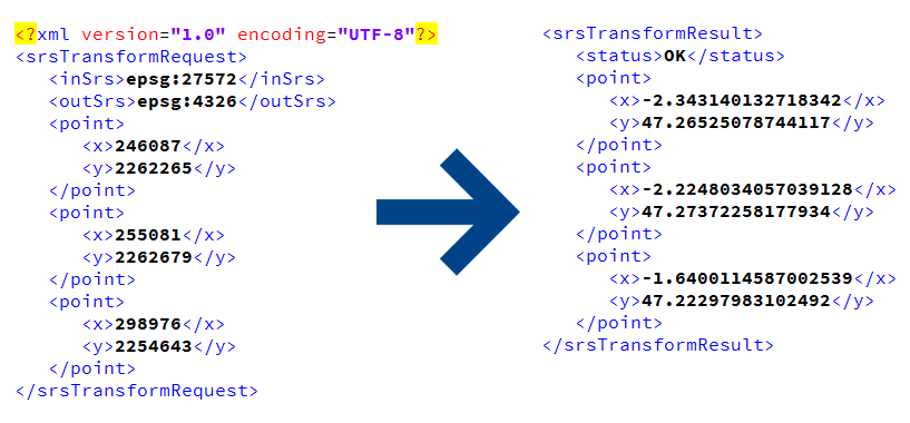
Use the coordinates transformation web service to project coordinates as you like. For example, convert from extended Lambert 2 to WGS 84.

Weather conditions display
Temperature, the amount of sunshine, wind, precipitation… Knowing the weather conditions for the next 7 days allows to anticipate possible delays or problems by reducing vehicle travel speeds and/or extending visit durations. In addition to consult, this API enables to define trigger thresholds in order to automatically receive notifications in the event of severe weather conditions.